GPS tracking system or Fleet management system simply means tracking vehicles of your fleet with accuracy and consistency. But this accuracy and consistency can be difficult to achieve sometimes. Let us go through one simple example to understand it better.
Suppose you have an important consignment to deliver to a destination. And a route to the destination consists of tunnels, mountain areas and remote locations. You can not rely on GPS all the time in this type of terrain.
GPS signals might get lost because of various reasons like dense areas, underground routes, tunnels, GPS malfunction. In addition to this, in this type of conditions, chances of accidents and vehicle theft increases.
In such a situation, if the GPS signal is lost then it becomes extremely difficult for a fleet manager to track and monitor the fleet. And your tracking system won’t be able to help you out when you most need it.
What is LBS?
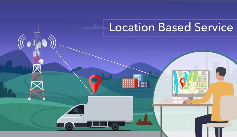
LBS stands for location-based service. It is designed for tracking your vehicle with the help of cellular towers. So, a vehicle is located by coordinates of the closest GSM base station. LBS is not as accurate as GPS, but it’s very helpful when GPS positioning data is unavailable.
LBS makes use of embedded satellite navigation receivers or network-based technologies such as cell identification or triangulation from the location of the base station transmission cells to determine the position.
How does it work ?
To track vehicles, one makes use of the GPS Tracking system. Which receives coordinates from the satellite and uses its latitude & longitude to provide you with the exact location of the object. Now, to obtain the accurate location continuously a high-speed internet is required. And if your vehicle moves in the region where there is no internet, then it becomes impossible to track your vehicle.
In this case, the LBS tracker sends data to the software with additional parameters mentioned below. These parameters help software in identifying the location of the closest cellular tower to the device. Therefore to locate a vehicle by LBS, the device should send at least 4 parameters: MCC, MNC, LAC & Cell ID.
- MCC (Mobile Country Code) identifies the country code for example: India – 404, USA – 310, Hungary – 216 so on.
- MNC (Mobile Network code) is a unique code which identifies a mobile network operator. For example MNC – 02 -Vodafone India (Delhi Operator), MNC – 10 – Airtel India (Delhi Operator) so on.
- LAC (Location Area Code) each location area consists of a set of base stations that are grouped together to optimize signalling. Each location has its own unique number. For example LAC – 011 -Delhi, LAC – 212 – New York.
- Cell ID is a unique number used to identify each Base transceiver station (BTS) or sector of a BTS within a Location area code. A valid CID ranges from 0 to 65535 on GSM and CDMA networks and from 0 to 268,435,455 on UMTS and LTE networks.
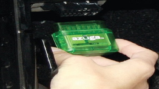
The LBS device used in vehicles consists of GSM sim card so whenever the software doesn’t receive GPS signal from the satellite network, LBS device makes use of the above-mentioned parameters and collects data from the multiple Cellular towers. It then checks in which country, region and area your vehicle is moving with the help of those parameters. And provides you with the location of your vehicle.
Author:
Tushar Bhagat, Director, Uffizio India Software Pvt Ltd
Published in Telematics Wire