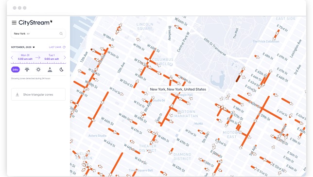
Nexar, an AI computer vision company, announced the release of CityStream™ Live, the company’s Real-Time Mapping (RTM) platform. CityStream™ Live enables the mobility industry, including connected vehicles, maps, mobility services, digital twins or smart city applications, to access a continuous stream of fresh, crowdsourced road data. Only with real-time data can vehicles really know what’s coming their way, react to varying speed limits, avoid work zones, find parking and someday drive themselves.
As software is “eating” vehicles and roads, today’s digital maps fall short of the freshness and precision that software-driven auto OEMs, autonomous vehicles, and mobility players require. Standard mapping methods – such as SD, HD, and traffic maps – fail to provide accurate, up-to-date, and cost effective solutions. By introducing new and disruptive RTM technologies at the edge of the network, Nexar’s CityStream™ Live is transforming how road information is captured and delivered to the mobility ecosystem. In addition to the company’s applications for detecting work zones, road sign changes, potholes, and free parking spaces, this new platform will provide unprecedented levels of freshness on nearly every road across the US at a dramatically reduced cost.
Utilizing a crowdsourcing network and edge AI software, CityStream™ Live offers users and developers a live data feed to increase situational awareness, enhance driving capabilities, increase safety, add comfort and help solve everyday mobility challenges. With over 700,000 vehicles in Nexar’s network of cameras capturing 94% of US roads each month, Nexar collects 3 billion miles of road vision data per year. By combining massive data aggregation with on-the-fly data curation, CityStream™ Live is the first platform to deliver road data streams in real time and at scale, supporting an unprecedented number of urban and highway use cases.
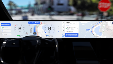
“Other companies in this space, such as Tesla and Mobileye, have been working on similar mapping capabilities,” said Eran Shir, Nexar’s CEO and cofounder. “However, their solutions are dependent on closed platforms and specific car models, which makes them unsuitable for general use in a vast range of vehicles and mobility applications. CityStream™ Live uses the same principles as Google PageRank did back in the 90’s, harnessing crowd wisdom to index the web at 40x lower costs. This allows partners and customers the real-time mapping APIs and tools they need in a technology-agnostic way, independent of the Camera or base map used. Our real time mapping is ready and available for you and your business needs, no matter what vehicle.”